https://youtu.be/g7gfDqiScpw LIDAR CONTOURS: How to import a LIDAR Digital Elevation Model (DEM) to Autodesk Civil 3D. This uses a GEOTIFF file (.tif) downloaded from https://elevation.fsdf.org.au/ (better know as ELVIS!) BOUNDARY LINES: How to import a ESRI Shapefile into Autodesk Civil 3D. This uses a SHP (.shp) file downloaded from … [Read more...] about How to import a LIDAR TIF file into Civil 3D
Civil Drafting
Civil 3D Tutorial For Beginners – Create a longsection without death from a thousand cuts!
How can I create a longsection (profile view) of a driveway design in Autodesk Civil 3D? In this tutorial I show you how to do this. I also show you how not die, a painful software death of frustration, with some power user tips and tricks. The Civil 3D template for Australia mentioned in this video can be download from this URL: … [Read more...] about Civil 3D Tutorial For Beginners – Create a longsection without death from a thousand cuts!
Types of GIS Data Formats
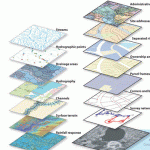
There are many types of GIS data formats. Shapefiles are one of the popular ones.Several format options are described below.Shapefiles (SHP) – This is probably the most common data format, and almost any GIS-enabled software can read a shapefile. A SHP typically consists of four file … [Read more...] about Types of GIS Data Formats
Decimal Sheet Numbering for Civil Drawings
Sheet Numbering Concept The core concept of this system is to break the drawing sheets into more manageable chunks by isolating elements into groups. The Divisions Division Description Remarks C00 Civil coversheets and general notesProject Title, General Notes, Drawing Schedule C01Site, existing conditions, demolition, landscaping etc.Overall plans C02Site … [Read more...] about Decimal Sheet Numbering for Civil Drawings


