In the world of Computer-Aided Design (CAD), precision and clarity are paramount. A crucial element in achieving this is the consistent and correct use of units. For those working within the metric system (SI units), understanding which unit to employ for different types of drawings can streamline workflows, prevent errors, and ensure universal comprehension. This post will … [Read more...] about Decoding Metric: Choosing the Right Units for Your CAD Drawings
CAD Standards
A New Way to Certify
If you love collecting certificates and quailifcations, this new offering may interest you from Autodesk. Whether you’re an emerging or seasoned professional, Autodesk's certification program gives you the tools and training to acquire new skills, accelerate your career, and prosper through disruption to achieve the new possible. Check it out at: … [Read more...] about A New Way to Certify
ISO3098B.SHX Font for AutoCAD
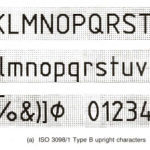
ISO3098B font style - An Engineering Drafting Standard. About SHX and SHP files File extensions SHX and SHP are both shapefile formats. These can be used to define text fonts or symbol fonts in AutoCAD. An SHX file contains a shape or font compiled by Autodesk AutoCAD from an .SHP shape file or .PFB font file. It stores shape definitions, as well as font definitions for … [Read more...] about ISO3098B.SHX Font for AutoCAD
Standard colors and line weights in CAD
Complied by Allan. Color your judgment In a CAD system, colors are most commonly used to represent line weights. Selecting different colors is just like picking up pens with varying line thickness. We then tie these colors into layers to control the visibility of drawing components. There are no right and wrong coloring systems — but there are some that have become … [Read more...] about Standard colors and line weights in CAD
ANSI Paper Sizes
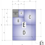
Architectural Paper Sizes North America has a special series of paper sizes defined for architectural purposes. In general these have aspect ratios of 4:3 or 3:2 which are similar to the aspect ratio of computer screens. Sizes are used for technical drawings in Structural Engineering, Mechanical Engineering, HVAC Engineering, Hydraulic Engineering, Electrical Engineering, … [Read more...] about ANSI Paper Sizes
Spatial Data Formats
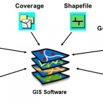
Information Type Preferred Format Extension Comments CAD (Computer Aided Design) Data AutoCAD Drawing file DWG Shall be compatible with AutoCAD Release 2007 GIS Data ESRI Shapefile SHP, SHX and DBF GIS Data Geodatabase oracle spatial SQL server SAP ESRI personal geodatabase Digital Elevation Models Band Interleaved by … [Read more...] about Spatial Data Formats


